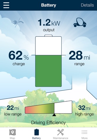
GEM RiderX map highlights local residential roads to guide the user’s understanding of roads that are available for LSV travel. The map uses GPS to locate current vehicle location and direction of travel and brings residential (typically roads with lower speed limits) to the users attention and de-emphasizes higher speed roads to indicate not usable with LSV. When GEM RiderX app is paired with the RiderX Link, it communicates key vehicle parameters:
* Distance remaining (range from most efficient, least efficient, and average vehicle consumption)
* Efficiency (based on average vehicle use)
* Charging Status
* Charging Time Remaining
* Cost per mile
* Charging Cycles
* Fault codes
* Battery state of health
* Energy used (cumulative)
* Manual entry for maintenance record
Continued use of GPS running in the background can dramatically decrease battery life.


